- Merlion Park The Merlion at the mouth of the river
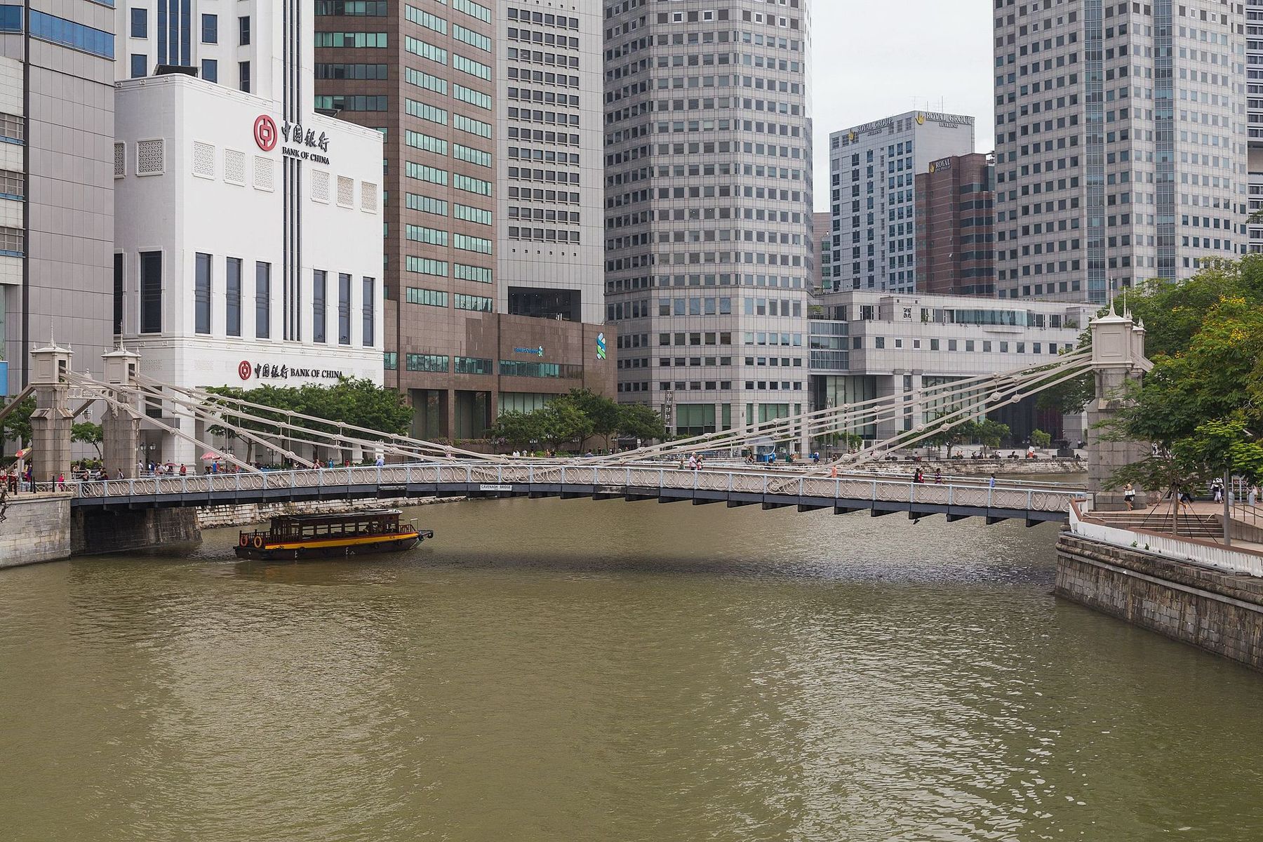
- Cavenagh Bridge Iron suspension bridge of 1869, now for walkers
- Raffles' Landing Site White statue on the north bank
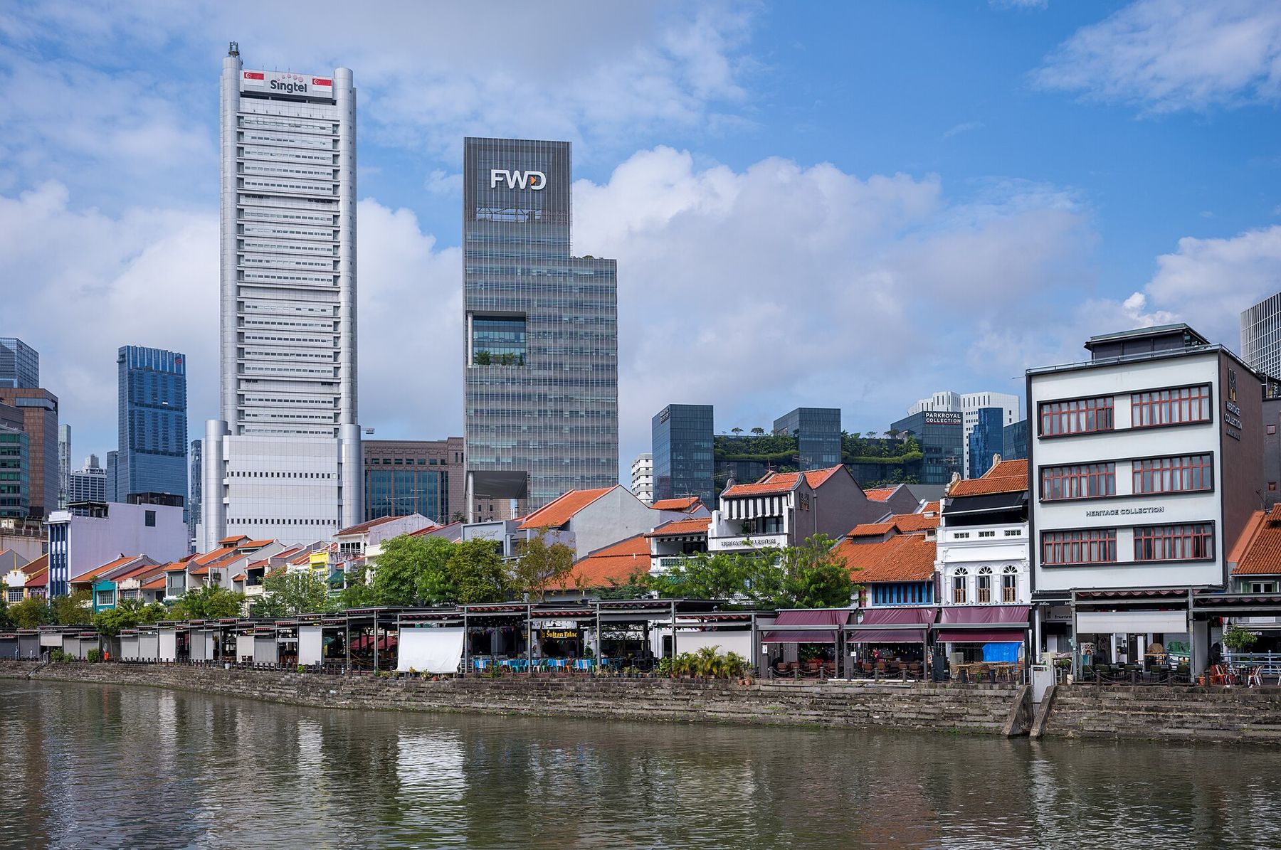
- Boat Quay Shophouse row on the river's curve
- Elgin Bridge 1920s road bridge with cast-iron lamps
- Clarke Quay Old godowns turned restaurants and nightlife
- Robertson Quay The quieter upper river, cafes and trees
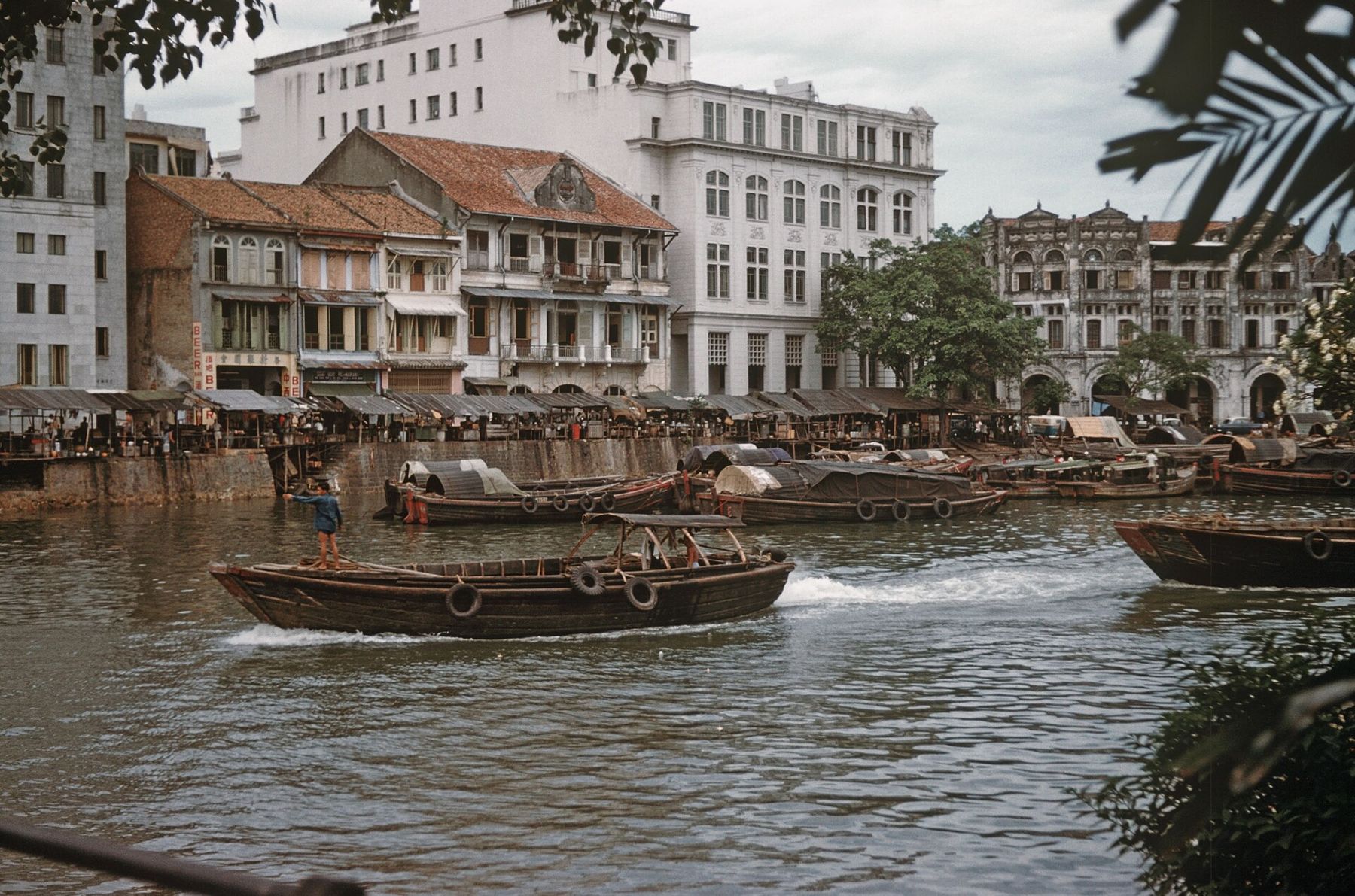
In old photographs of the Singapore River, you can barely see the water. Lighters crowd the banks three and four deep, their hulls painted with eyes at the bow so they could see their way, their decks piled with sacks and crates. Coolies trot along gangplanks with loads on their shoulders. Behind them stand the godowns and shophouses, and the smoke of a hundred cooking fires hangs over it all.
The river was the city's working heart for a century and a half. Today it is clean, quiet and lined with restaurants, and the boats on it carry tourists rather than rice. This walk follows it upstream from its mouth, past the bridges, the quays and the old warehouses, and tells the story of how it changed.
Merlion Park
Start at the river mouth, where the Merlion stands spouting water into the bay. The statue, a creature with a lion's head and a fish's body, was unveiled in 1972 near the old mouth of the river and moved to this spot in 2002, after new bridges blocked the view of it from the bay. It is some eight metres tall and almost always surrounded by people taking photographs, most of them pretending to drink the water from its mouth.
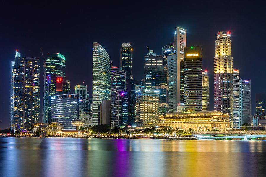
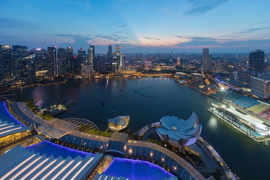
The view from here is one of the best in the city. Across the bay are Marina Bay Sands and the domes of the Esplanade; behind you are the towers of the financial district, and between them the old, low buildings of the river's colonial past.
Cavenagh Bridge
Walk upstream along the waterfront, past the grand colonnaded Fullerton Building, which was completed in 1928 as the General Post Office and now houses a hotel. Ahead is Cavenagh Bridge, a white iron suspension bridge that opened in 1869 and is one of the oldest bridges in Singapore. It was built to link the government quarter on the north bank with the commercial district on the south.
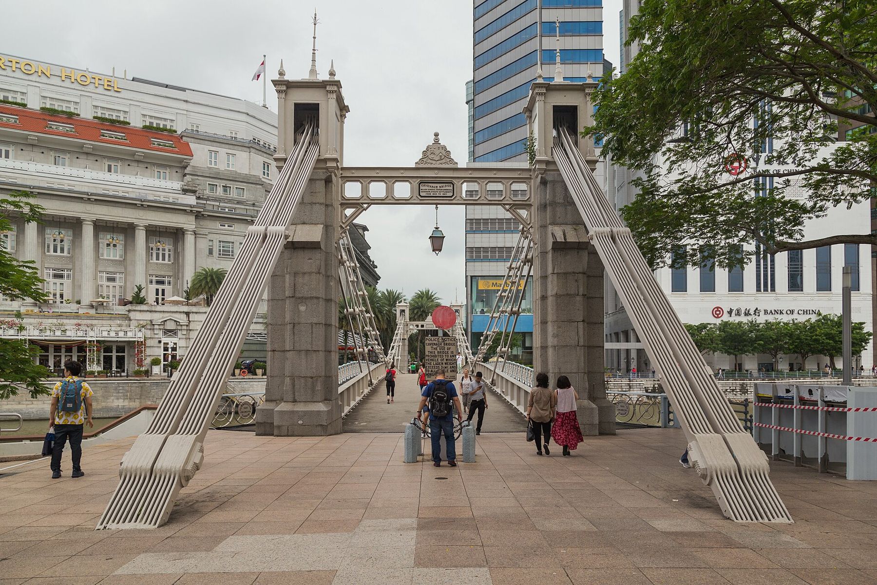
The bridge soon proved too low for boats at high tide and too narrow for the growing traffic, and a new road bridge, Anderson Bridge, was built downstream in the early twentieth century. Cavenagh Bridge became a footbridge. At each end, an old police notice still prohibits heavy vehicles and cattle and horses from crossing. Near the bridge, bronze sculptures of boys leaping into the river recall the days when children swam here.
Raffles' Landing Site
Cross the bridge to the north bank and turn left. A white statue of Stamford Raffles, arms folded, stands at the spot where he is believed to have landed in 1819. It is a copy of the bronze statue that stands in front of the Victoria Theatre and Concert Hall a short walk away. Behind the statue is the Asian Civilisations Museum, in a grand colonial building, and the old Parliament House and the colonial core beyond.
From here you look across the river at Boat Quay and the skyscrapers rising behind it, the oldest and newest of the city side by side. It is the view on a thousand postcards, and it is still remarkable.
Boat Quay
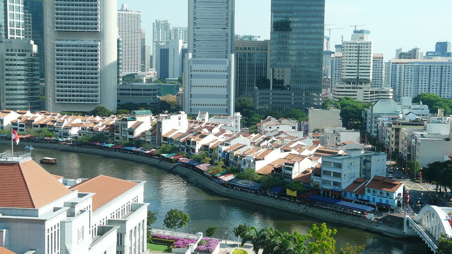
Cross back over the river to Boat Quay, on the south bank. The quay follows a curve in the river that the Chinese merchants called the belly of the carp, a sign of prosperity, and the shophouses that line it were once the offices and warehouses of the traders who ran the river's commerce. In the nineteenth century, Boat Quay handled much of Singapore's trade.
 Next stall overSingapore's skyline, explained from the water's edge
Today the shophouses are restaurants and bars, with tables spilling out onto the waterfront and touts offering menus as you pass. The shophouses are low, two or three storeys, and painted in bright colours, and the towers of the financial district rise directly behind them. In the evening, the quay is crowded with office workers and visitors eating and drinking by the water.
Elgin Bridge
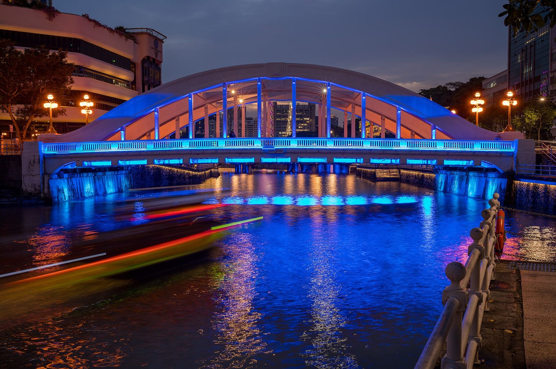
Continue upstream to Elgin Bridge, a road bridge completed in 1929, with cast-iron lamps and decorative details. It stands roughly where the first bridge across the river was built in the early years of the settlement, and it links the old Chinese district on the south bank with the government quarter to the north. Pause in the middle and look downstream: the view of the river curving past Boat Quay toward the bay is one of the finest on the walk.
Clarke Quay
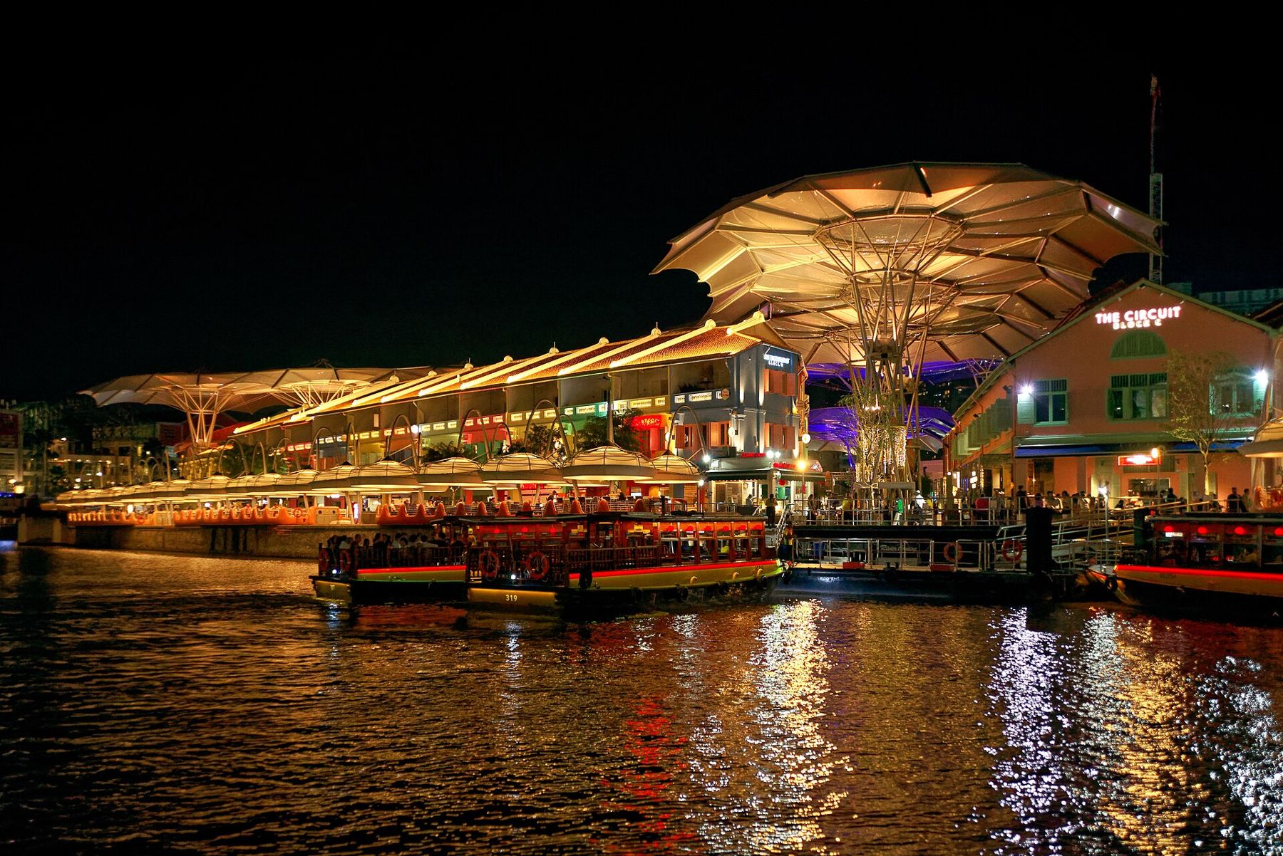
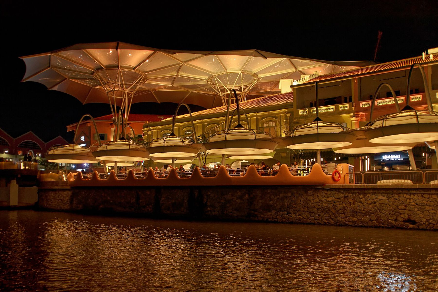
Beyond Elgin Bridge, past Coleman Bridge, the river reaches Clarke Quay. This was the warehouse district, lined with godowns where goods were stored after they came off the lighters. The godowns are now restaurants, bars and nightclubs, painted in bright colours and covered by big canopies that keep off the sun and rain. In the evening, Clarke Quay is the busiest part of the river, loud and lit up, with music spilling out of the bars and crowds along the waterfront.
If you prefer quiet, cross to the north bank and walk along the riverside promenade there, where the noise fades and you can watch the lights reflected in the water.
Robertson Quay
Keep walking upstream, past more bridges, to Robertson Quay. This is the river's quieter end, with apartment blocks, hotels and cafes along the water and big trees shading the promenade. In the morning, it is full of joggers and dog walkers; in the evening, people sit at the waterfront cafes and watch the river go by. It is the best place on the river to end a walk with a drink or a meal.
How the river changed
By the 1970s, the river was badly polluted, its water black and foul with waste from boats, hawkers, workshops and the homes along its banks. In 1977, the government launched a ten-year campaign to clean it up. The lighters were moved out to Pasir Panjang, the hawkers were moved into food centres, and the squatters and backyard industries were resettled. By 1987 the river was clean, and fish had returned to its waters.
The quays were then restored and turned into the dining and nightlife districts you see today. The change was dramatic and, for some, a loss: the river lost its working life, its noise and its smell. But it gained a second life, and it remains one of the most pleasant places to walk in the city.
Practical notes
The walk is flat and paved, with promenades on both banks and bridges to cross back and forth. It is easy to join and leave at any point; the Raffles Place, Clarke Quay and Fort Canning MRT stations are all close to the river. Go in the late afternoon and stay into the evening, when it is cooler and the lights come on. River cruises run along the river from several jetties, and they make a pleasant way to see the quays from the water; fares and timetables change, so check before you go. For the bay beyond the river mouth, see our story on Marina Bay.
End at Robertson Quay as the evening settles in, with the river dark and still and the lights of the quays shining in it, a long way from the crowded, noisy, working river of the old photographs.