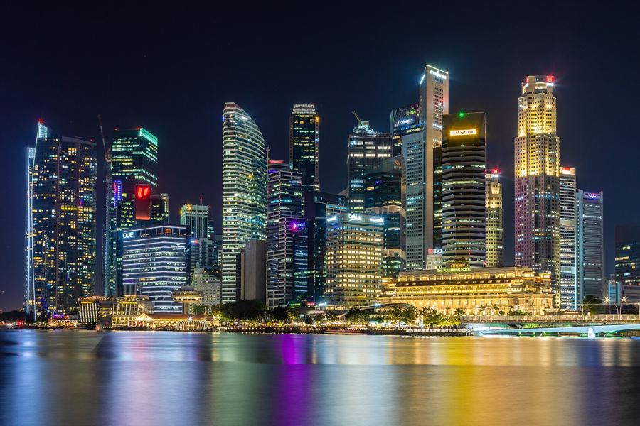
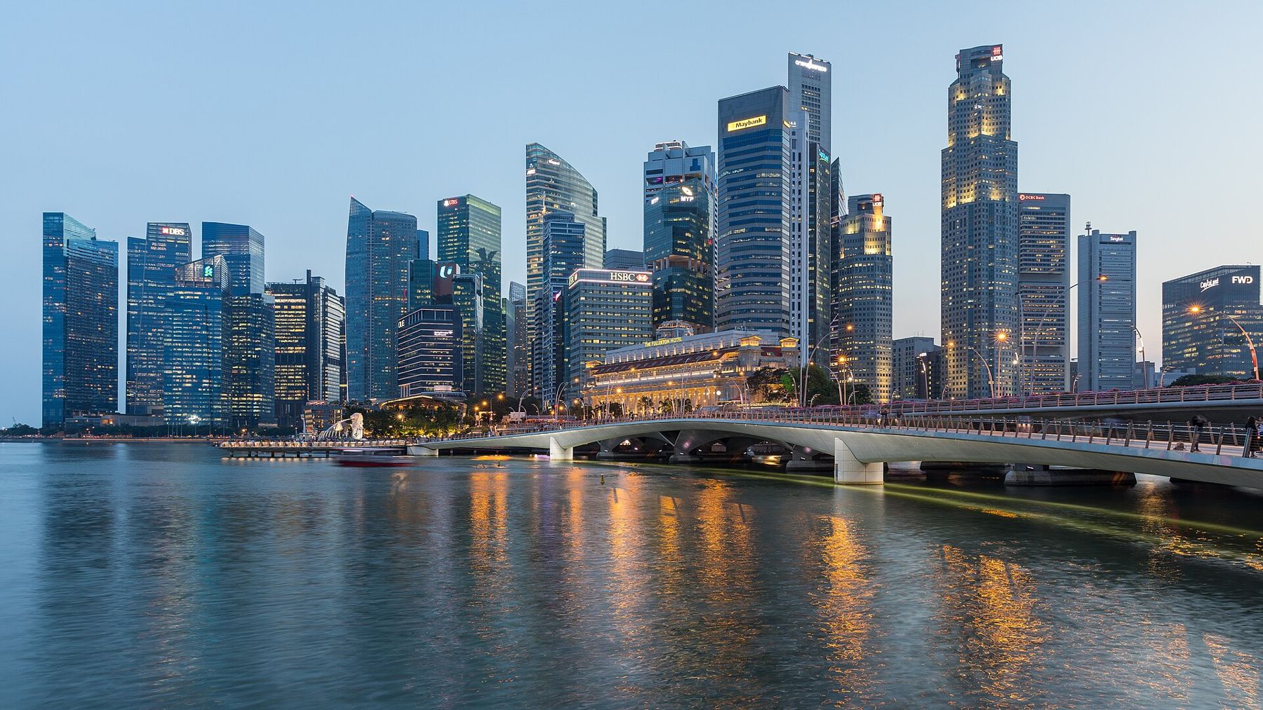
Singapore's skyline is best read from the water. Stand on the steps of the Esplanade at dusk and it unfolds from left to right: the towers of the financial district packed tight around Raffles Place, the low colonnade of the Fullerton Building at the river mouth, the newer glass towers along the southern shore of the bay, and, across the water, the three towers and the long deck of Marina Bay Sands. Here are the questions people ask most about it.
Which tower is which?
The tallest cluster, behind the river mouth, is Raffles Place, the old heart of the financial district. Three towers stand out there. One Raffles Place is a sharp-edged, angular tower. UOB Plaza, with its two octagonal towers, was designed by the Japanese architect Kenzo Tange. Republic Plaza, a tall, faceted tower, was designed by another Japanese architect, Kisho Kurokawa. Around them stand dozens of other towers, of banks, insurers and law firms, too many to name.
To the right, along the southern shore of the bay, are newer towers built on reclaimed land: the Marina Bay Financial Centre and its neighbours, sleek glass blocks with offices and apartments. Farther south, in Tanjong Pagar, a tall, slender tower rises above the rest; it is among the tallest buildings in the city.
Why do the tallest towers stop at the same height?
Look closely at the Raffles Place cluster, and you will notice that the tallest towers are all about the same height, roughly 280 metres. That is not a coincidence. For decades, the height of buildings in the city centre was capped at about that level, mainly for reasons of aviation safety, because of the flight paths of aircraft using the island's airfields. A few newer towers have edged a little higher, but the cap is the reason the skyline looks so level at the top, like a row of books on a shelf.
What is the grand old building at the river mouth?
The long, low building with the Doric colonnade, at the mouth of the Singapore River, is the Fullerton Building. It was completed in 1928 and named after Robert Fullerton, the first governor of the Straits Settlements. For decades it housed the General Post Office and government offices, and it was one of the grandest buildings in the city. Today it is a hotel, and its granite facade is lit at night, glowing gold against the dark towers behind it.
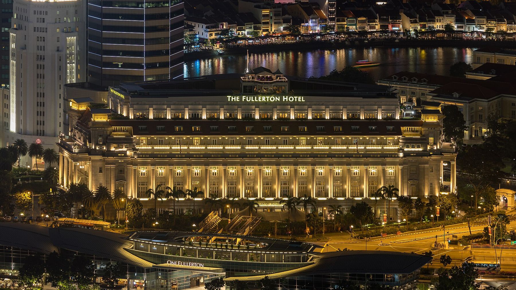
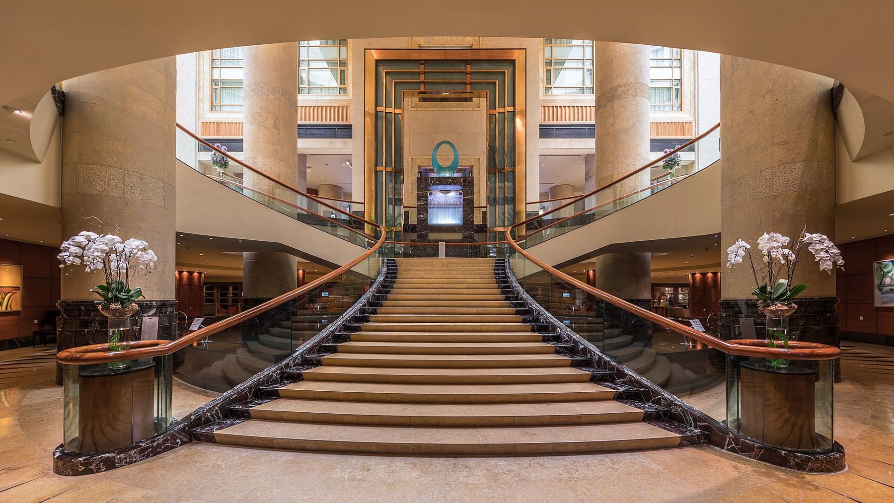
The Fullerton is a reminder of how the skyline has grown. When it was built, it was one of the biggest buildings in Singapore. Now it is dwarfed by the towers that rise behind it. Inside, the grand public rooms and staircases have been restored, and visitors can see them from the lobby.
 Next stall overAlong the Singapore River, from the Merlion to Robertson Quay
What is the ship on top of the three towers?
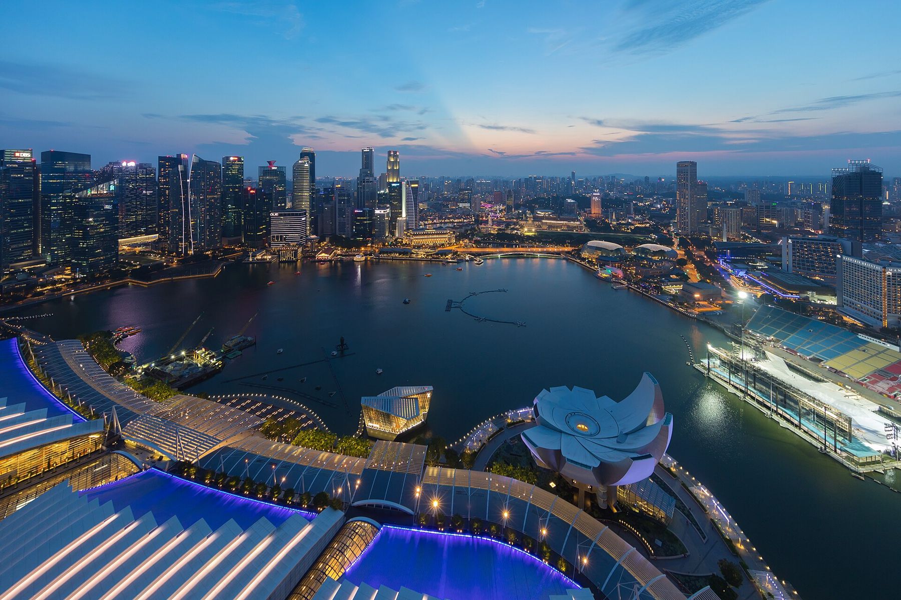
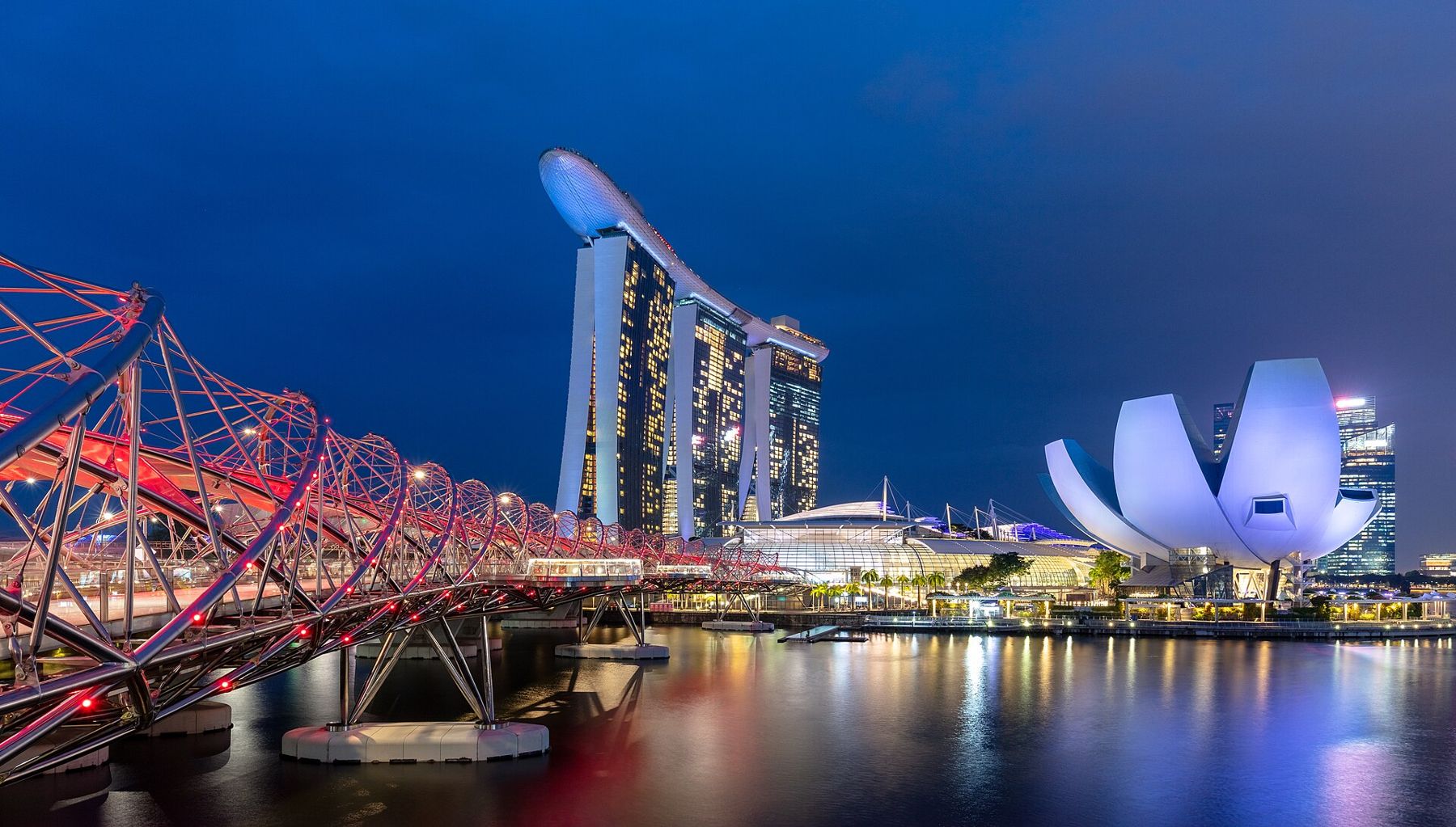
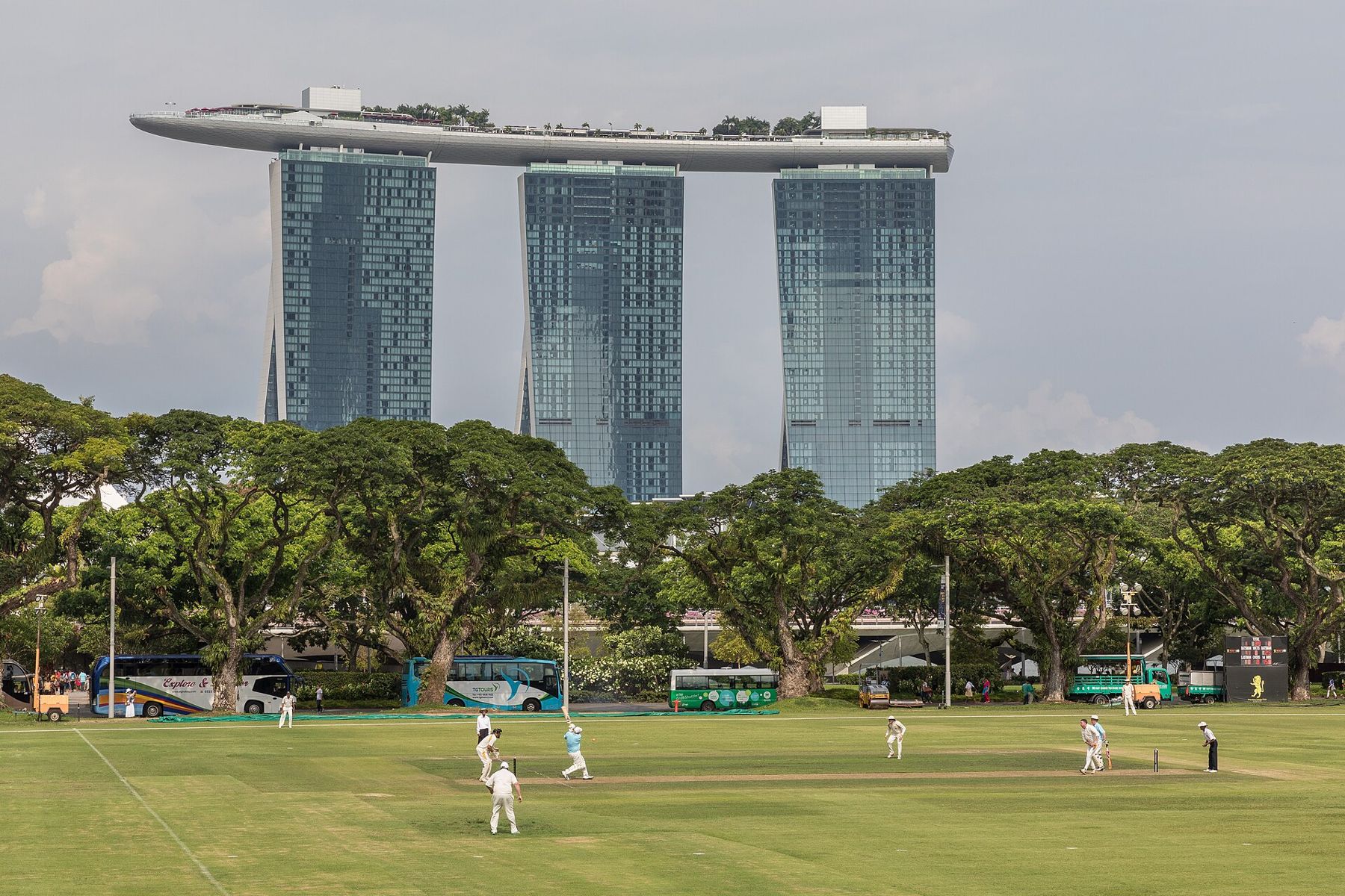
Across the bay stands Marina Bay Sands, the hotel and casino complex that opened in 2010. It was designed by the architect Moshe Safdie, and it consists of three towers, each roughly 200 metres tall, joined at the top by a long, boat-shaped platform, the SkyPark, with gardens, restaurants and an observation deck. One end of the platform cantilevers out beyond the last tower, hanging in the air over the ground below.
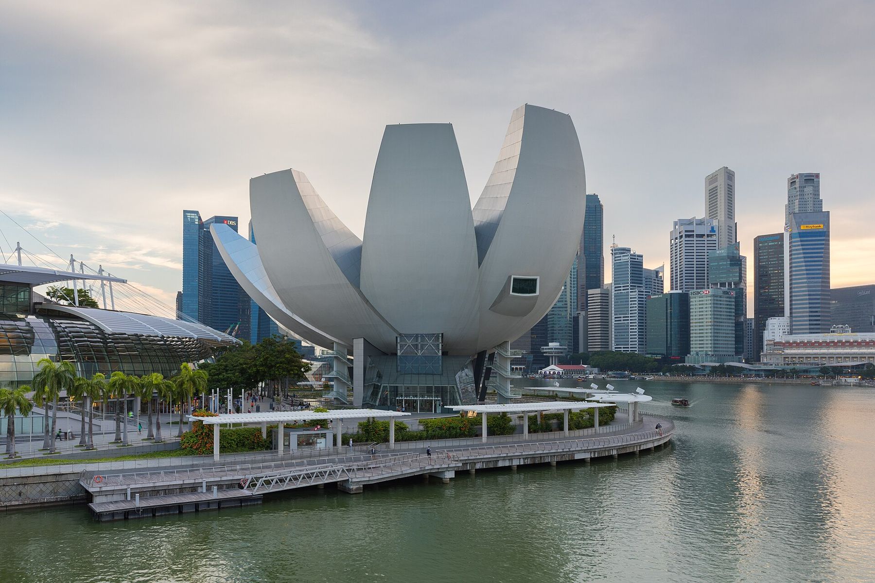
Beside it, the white building shaped like an opening lotus flower is the ArtScience Museum. Behind them lie the Supertrees and the domes of Gardens by the Bay.
Why are there old buildings at the feet of the towers?
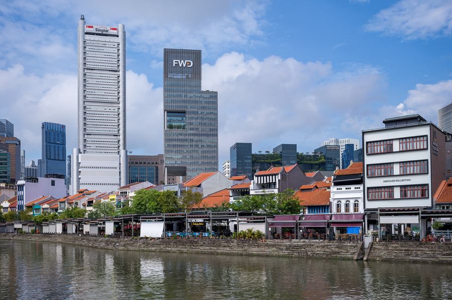
One of the striking things about Singapore's skyline is the contrast between the towers and the low, old buildings at their feet. Along the river, the shophouses of Boat Quay stand directly in front of the towers of Raffles Place, two or three storeys against fifty or sixty. That contrast is the result of planning. From the late 1980s, the government designated conservation areas, including Boat Quay, Chinatown and Kampong Glam, where the old shophouses had to be preserved. The towers were built behind them, and the old and the new now stand side by side.
For more on the shophouses and why they matter, see our story on shophouses.
Why are there so many plants on the buildings?
Look closely at many of the newer towers and you will see trees, shrubs and creepers growing on their balconies, terraces and roofs. This is deliberate. Singapore's planners encourage developers to include greenery in their buildings, often requiring them to replace the green space lost on the ground with planting on the building itself. The result is a skyline that is, in places, surprisingly green, with sky gardens and planted facades.
Who decides what gets built?
Singapore's skyline is the product of long-term planning. The Urban Redevelopment Authority draws up a master plan that sets out what can be built where, how high and how dense, and it reviews the plan regularly. The plan sets out the zones for offices, homes and parks, protects the conservation areas and the views of key landmarks, and shapes the look of the city as a whole. Few cities plan their skylines as carefully.
Where is the best place to see it?
The classic view is from the waterfront promenade in front of the Esplanade, looking across the bay to Marina Bay Sands and back toward the towers of Raffles Place. Merlion Park, at the river mouth, gives a similar view. For a wider panorama, go to the roof of the Marina Barrage, or to the shore of Bay East Garden, which looks back across the water at the whole skyline. For a view from above, there is the observation deck of Marina Bay Sands, which charges for entry. Walking the bay, as described in our story on Marina Bay, takes in most of these.
When does it look best?
The skyline is at its best in the blue hour, the half hour or so after sunset, when the sky turns deep blue and the towers light up one by one. On clear evenings, the light is soft and the reflections in the bay are perfect. Later in the evening, the free light and water show in front of Marina Bay Sands adds colour, and the Fullerton glows gold at the river mouth.
Sit on the steps by the water, wait for the lights, and watch the city switch itself on, tower by tower, from the river mouth to the far end of the bay.